A century of plans and photographs, from the first survey to the cemetery today.
Select any map to see it full size. They were prepared in 2019 for the cemetery’s landscape guide, and the oldest drawings are the Olmsted Brothers’ own.
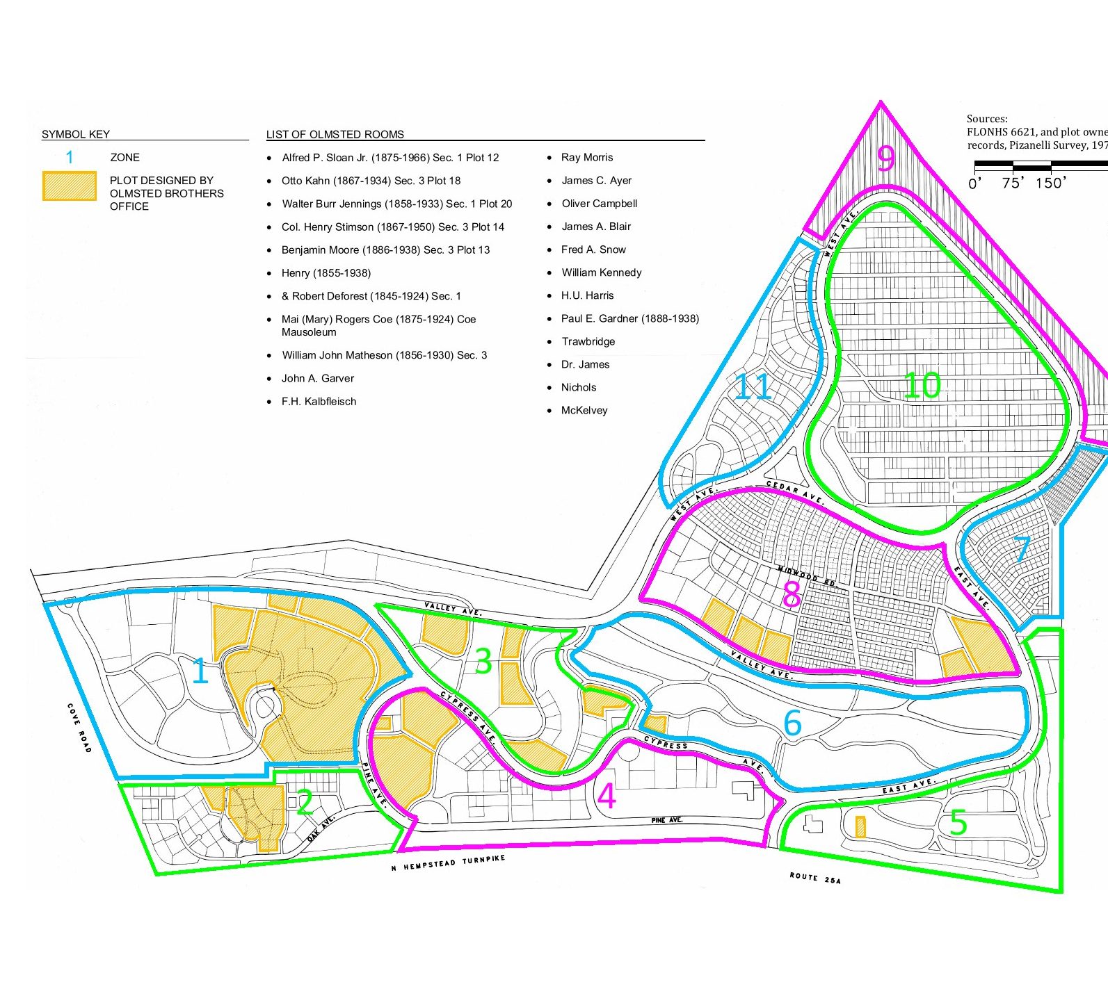
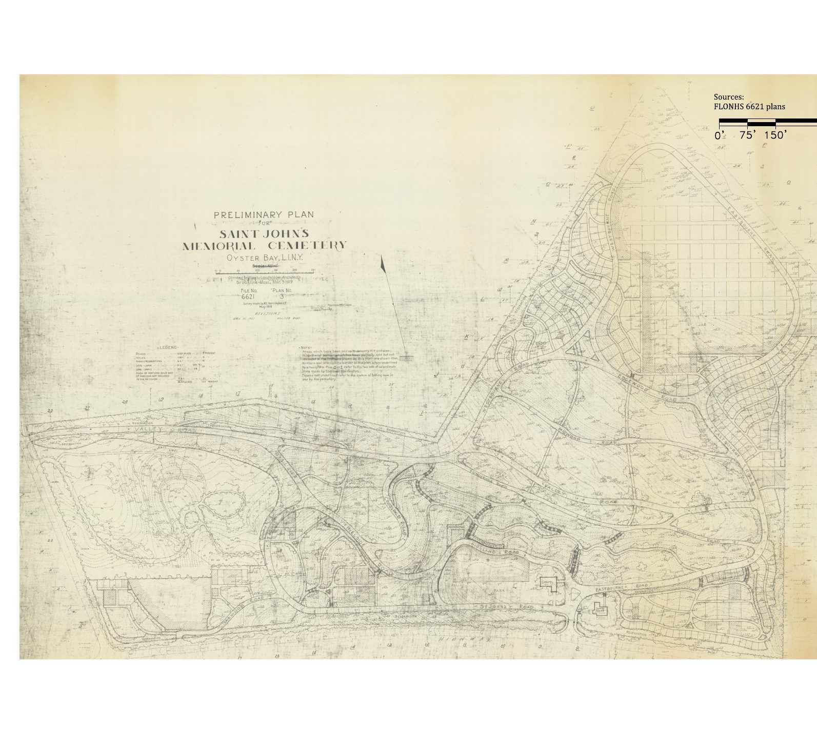
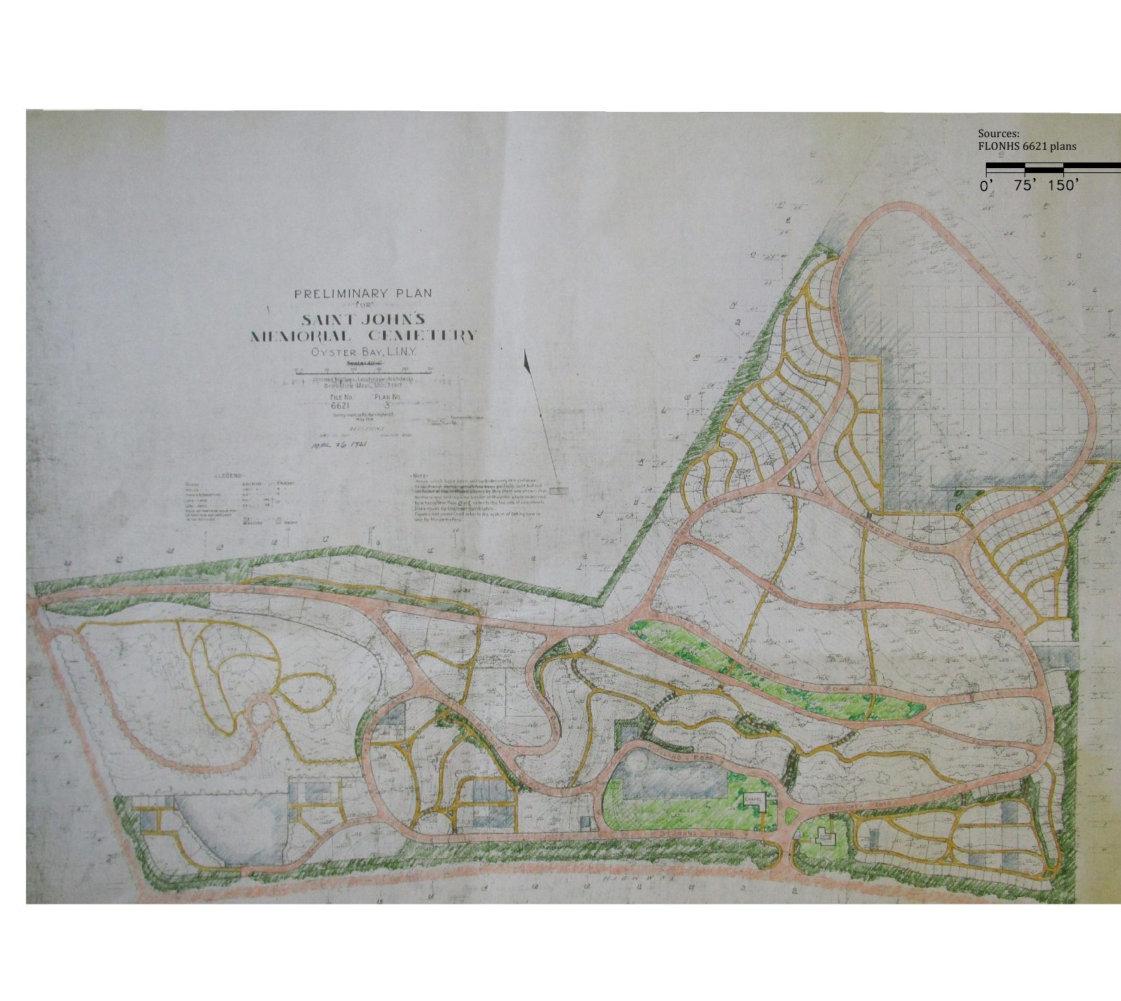
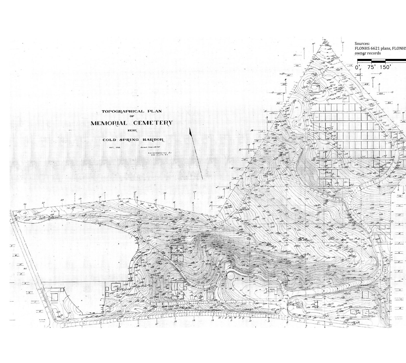
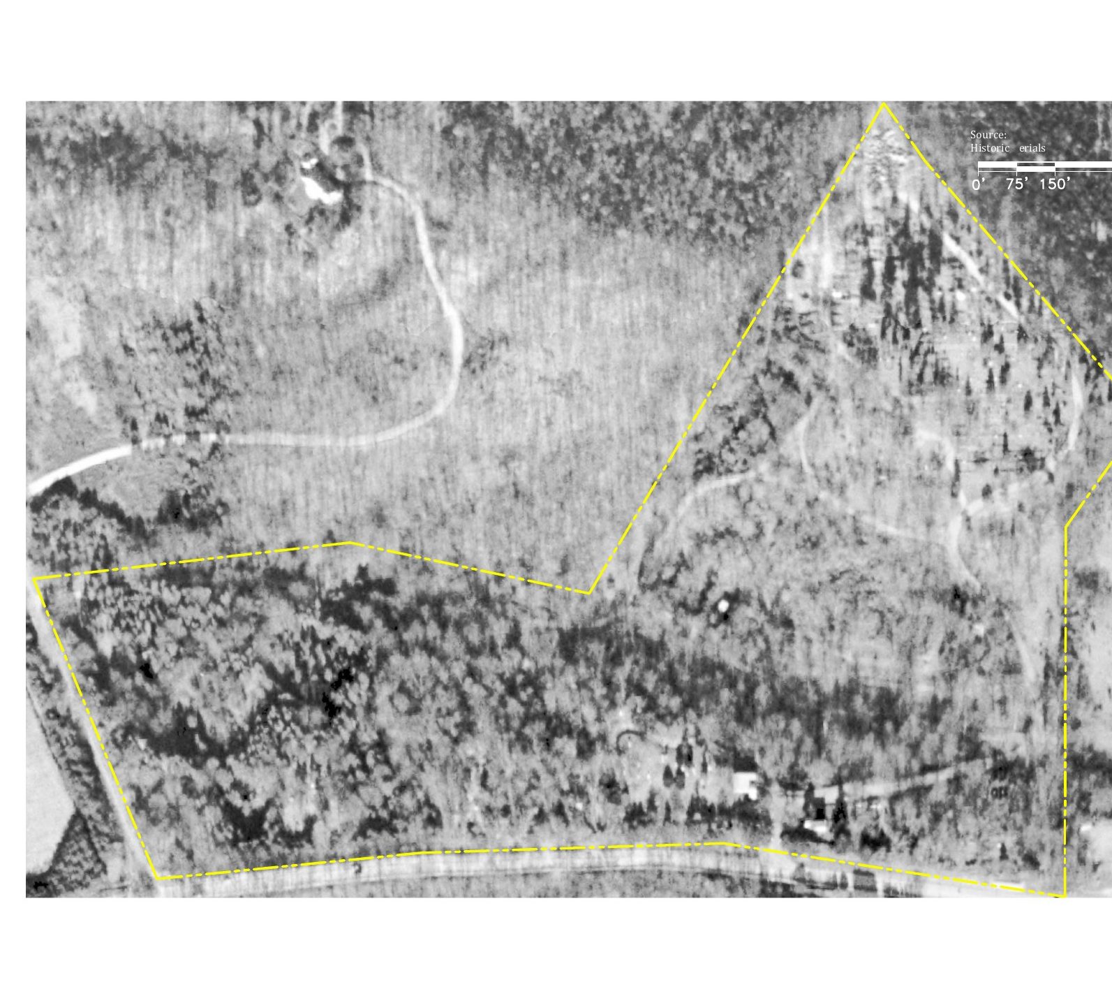
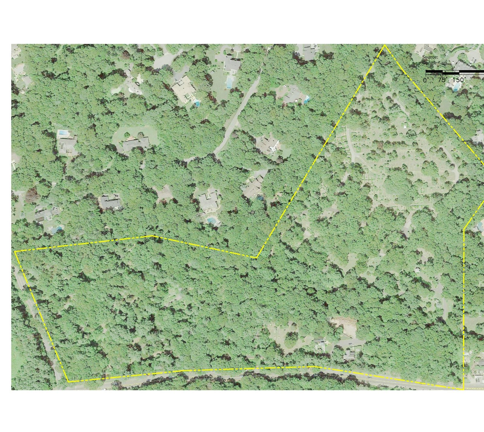
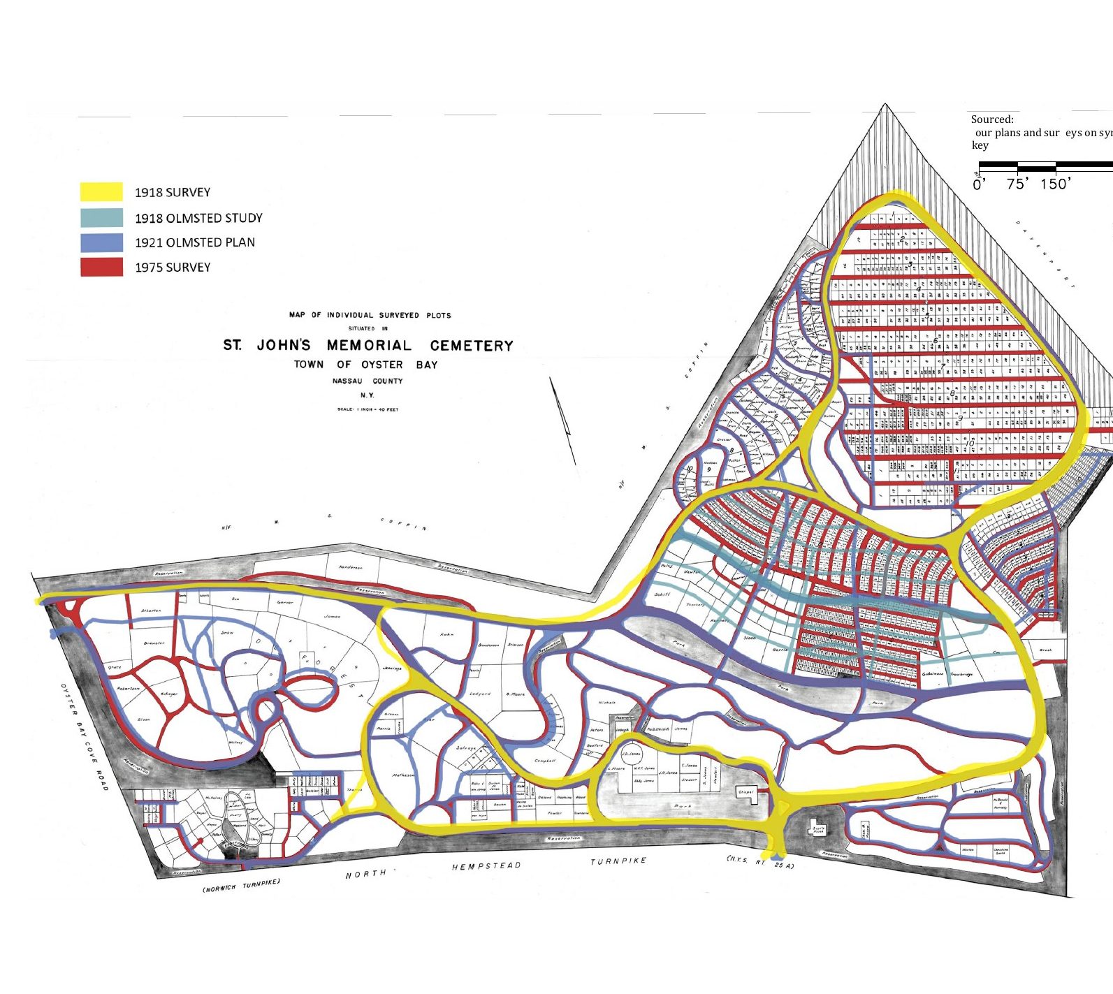
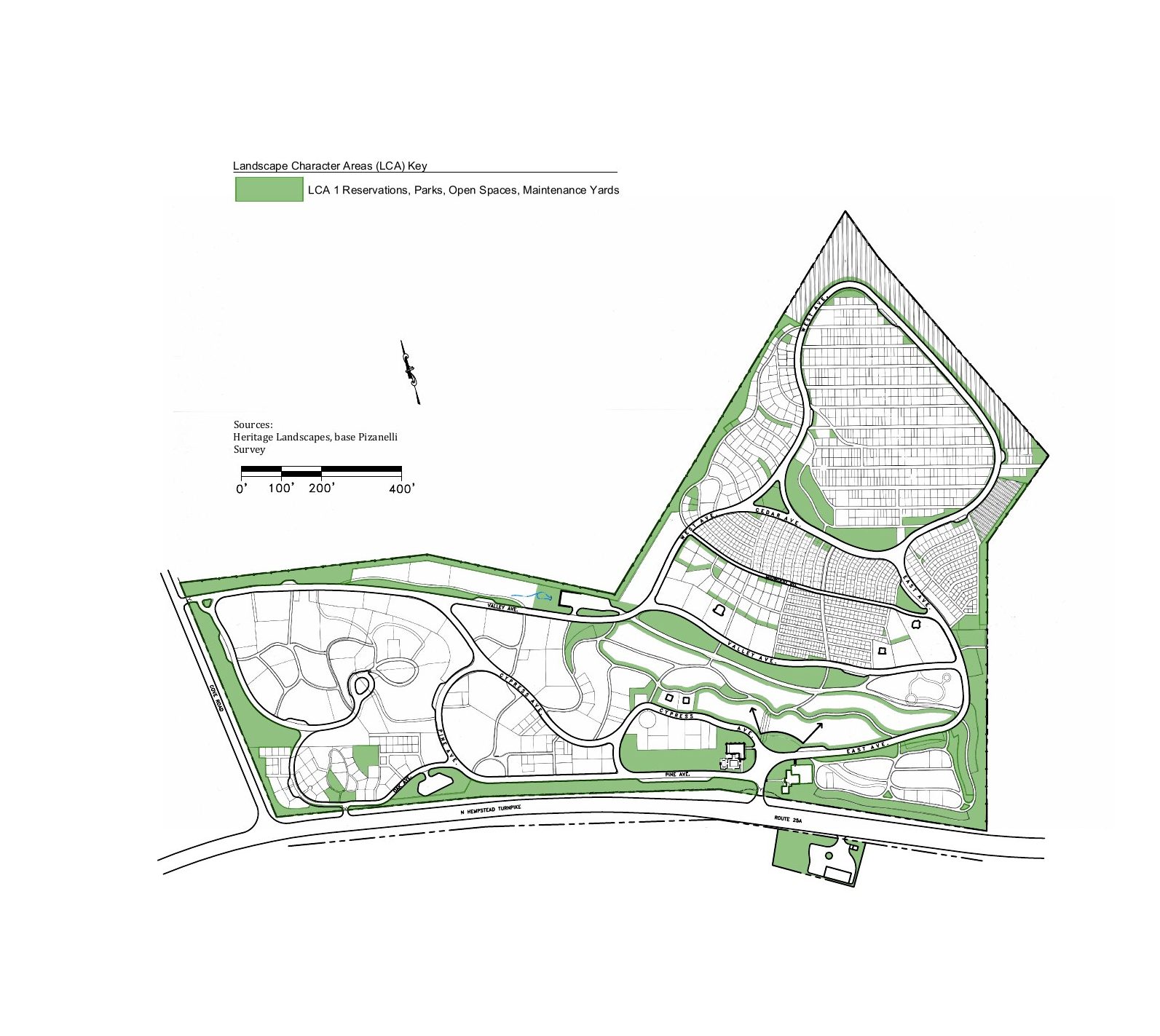
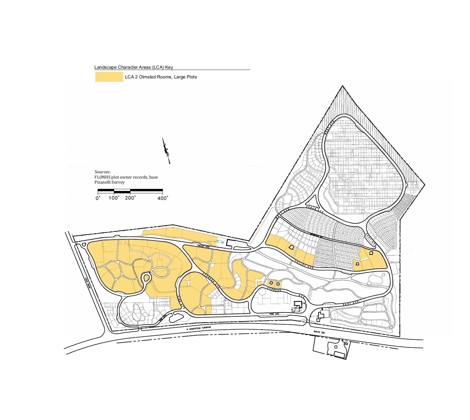
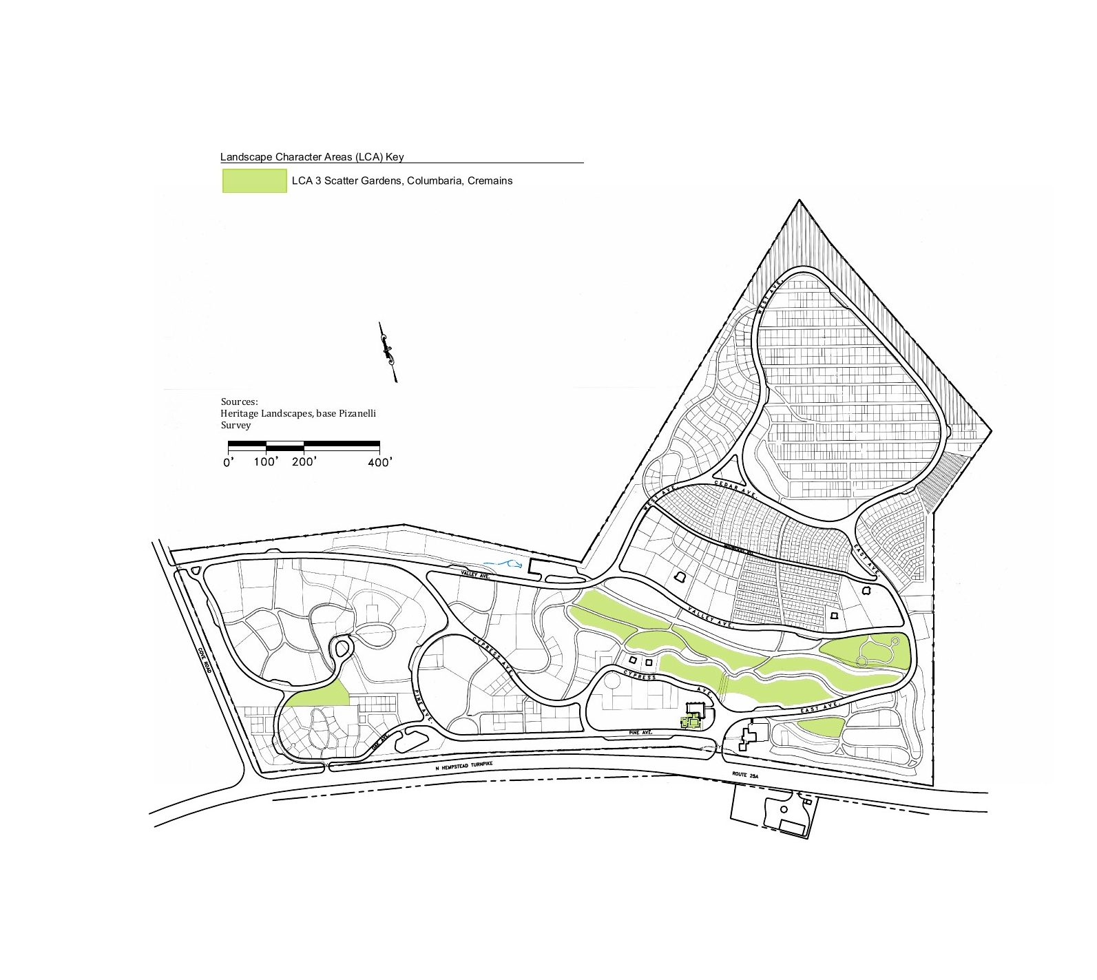
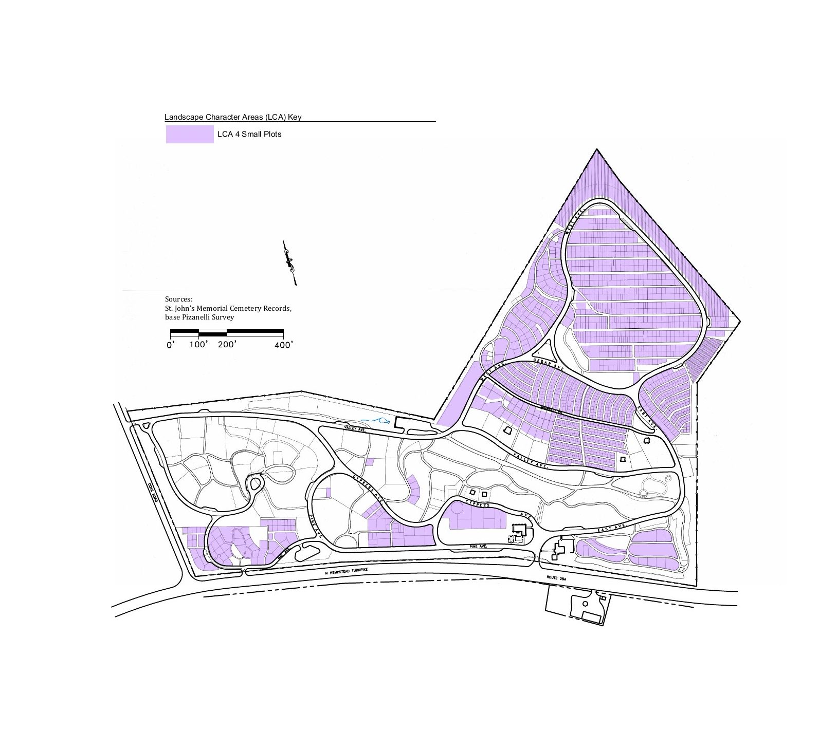
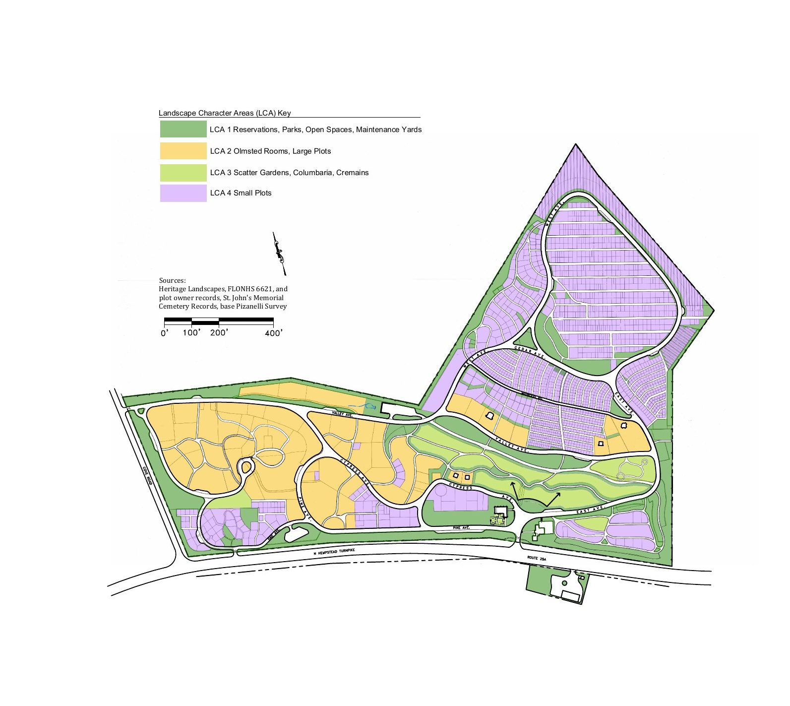
Zones and Olmsted rooms. The cemetery’s eleven numbered sections, with the family plots designed by the Olmsted firm shown in gold.The Olmsted Preliminary Plan, 1921. The plan that set out the drives, paths, parks, and wooded edges.The 1921 plan, in colour. Parks and reservations in green, drives and paths in peach and gold, small plots in gray.Survey of the grounds, 1918. H. C. Harrington’s topographic survey, made before the Olmsted designs.Aerial photograph, 1953. The grounds in the mid-twentieth century, with the Olmsted rooms in the west already under heavy canopy.Aerial photograph, 2018. The cemetery today, under its canopy of mature trees.How the roads and paths changed. The drives and paths of the 1918 survey, the Olmsted plans, and the 1975–95 survey, drawn on top of one another.Parks, reservations & open space. The green margins and open lawns that frame the cemetery.Olmsted rooms and large plots. The larger family plots, in gold.Scatter gardens & columbaria. Places for cremated remains, in light green.Small plot areas. Single and small family plots, in lavender.All four areas together. The four landscape areas on one plan.
Credits. Plans and drawings from the St. John’s Church Memorial Cemetery Historic Landscape Management Guide (April 2019) by Heritage Landscapes LLC for the St. John’s Memorial Cemetery Committee. Historic plans courtesy of the Olmsted Archives, Frederick Law Olmsted National Historic Site.